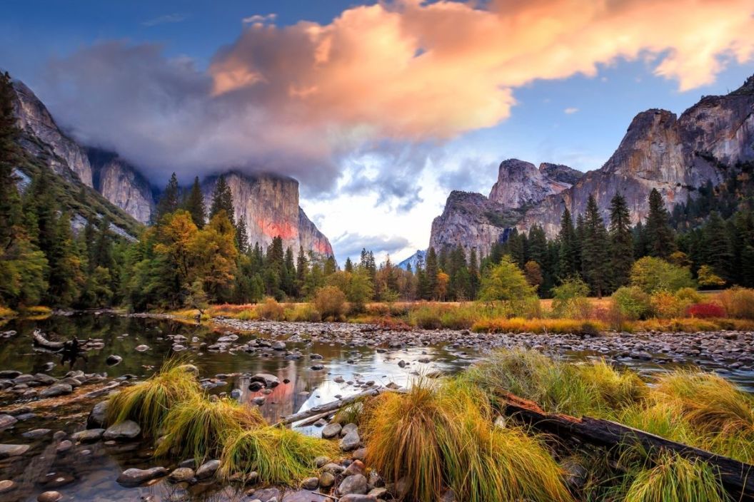
Easily one of the most majestic national parks in the United States, Yosemite is up in the rankings with giants like Yellowstone and the Grand Canyon. From breathtaking features such as the famous Half Dome, to historical attractions like the Ahwahnee Hotel, the park has something to offer every visitor, no matter their outdoor preference. And we've created the perfect guide to help you navigate your own Yosemite National Park map.
Where is Yosemite National Park?
Yosemite is located in the central stretch of Western California, close to the state's border with Nevada. The easiest way for folks to enter the park from the Nevada side is via the Tioga Pass Entrance around the Mono Lake area. Just take the I-395 to Highway 120, a.k.a. Tioga Road.
Yosemite is situated in the Sierra Nevadas between the Emigrant, Hoover, and Ansel Adams Wilderness Areas, as well as the Sierra, Stanislaus, and Inyo National Forests. It is far from a lot of the other things California is known for, like its big cities and beaches.
Map of Yosemite National Park
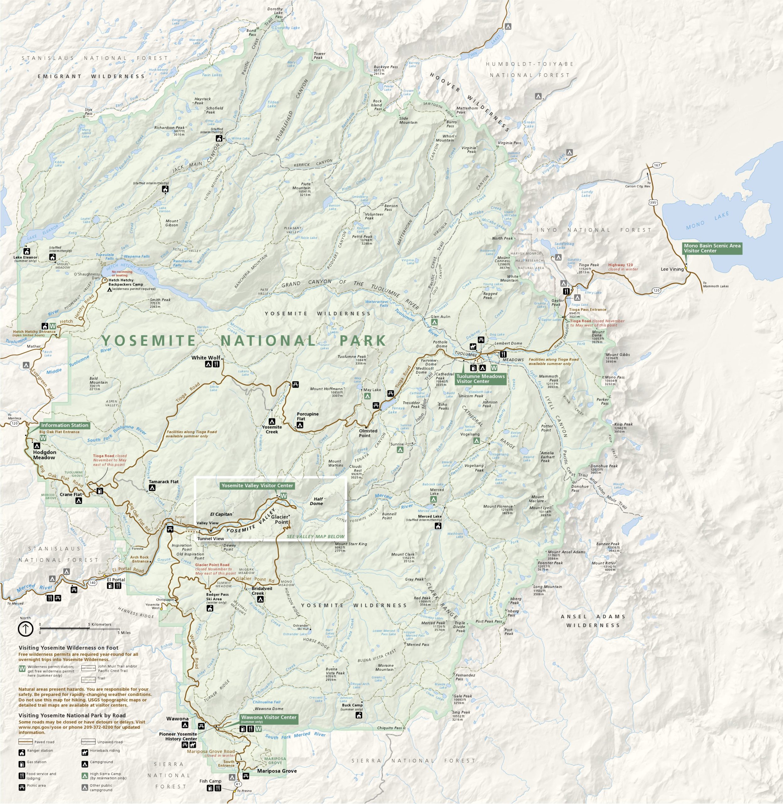
This Yosemite National Park Map is a great way to start planning your adventure. Since there's so much discover in Yosemite, you'll want to be sure to decide on an area to explore prior to making any serious arrangements.
Hikers looking for detailed trail maps should check out the www.nps.gov website, where they have full pages dedicated to each trail, not to mention printable brochures and topographic maps. If you're looking for an option that's more durable than a printable National Park Service map, head over to National Geographic's "Trails Illustrated" site. They have what are called "Backcountry Tough" options that are printed on tear and water-resistant paper.
Camping in Yosemite National Park
RELATED: Redwood National and State Parks Guard California's Coastline
Whether you're backpacking, doing an overnight climb, or camping outside of established campgrounds, you have to get a wilderness permit. These permits are issued on a first-come, first-serve basis and can be acquired in advance or in person. But be warned, permits can go pretty fast both online and in person, especially if they're for popular areas. Places you can get permits in person are marked with the letter "W" in green boxes on the map above.
Although there are a lot of rules and regulations regarding where you can spend the night and how, once you get through all the bureaucratic red tape, you've got a lot of options. Follow this link to the NPS's website for more information.
Top Spots to Visit In the Yosemite Wilderness
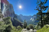
Yosemite Valley
This is the park's most popular area. It is full of iconic attractions like Yosemite Falls, El Capitan, Glacier Point, Mirror Lake... the list goes on and on, believe me. While the map above does include the valley area, you might want to head over to the NPS website for a more detailed Yosemite Valley map. If you're already in the park and looking for a map, try the Yosemite Valley Visitor Center.
The fastest way to get to Yosemite Valley is to take the 140 along the Merced River to the Arch Rock Entrance. From there, you have a lot of options, including a handful of hiking trails and scenic car routes like Glacier Point Road.
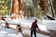
Mariposa Grove
Visitors coming up from the southern half of California often take highway 41 and use the South Entrance to reach the park. This is the second most spectacular way to enter the park after the 140, since it lands you right in the Mariposa Grove, which is one of the places in the park where you can see giant sequoias. Other features in the area include the Wawona Camp and Visitor Center, as well as the Pioneer Yosemite History Center.
Tuolumne Meadows
Next to Yosemite Valley, Tuolumne Meadows is the most popular section of the park. It has a ton of trailheads and is a great place to link up with both the Pacific Crest and John Muir trails. Popular spots around the meadow include Tenaya Lake and the Tuolumne River, making it a perfect destination for aquatic recreation.
Hetch Hetchy
This is one of the more remote sections of the park, making it a great choice for backpackers who want to avoid the more touristy areas so they can enjoy some serene Sierra Nevada hikes. It can be reached by way of the park's most northwestern entrance and has a backpackers' camp you need a permit to stay in.
Big Oak Flat
Just south of the Hetch Hetchy entrance you'll find the park's Big Oak Flat Entrance. It leads visitors to the Tuolumne Grove area and is the easiest way to reach lesser known campgrounds like Hodgdon Meadow, Tamarack Flat, and Crane Flat. This route is also the fastest way to reach the White Wolf campground, which is only open during Summer.
What's your favorite place to visit in Yosemite National Park? Let us know what's good on our Wide Open Roads Facebook!