Fall is many people's favorite time of the year: The crisp and cool weather invites leafpeepers—people who travel or hike to envelop in fall foliage—outside to enjoy the natural world's transition to autumn. Starting Labor Day weekend, folks from all over the country embark on adventures to chase the ever-changing colors of nature. And if you're one of those fanatics, did you know that there's a map to help you find those places?
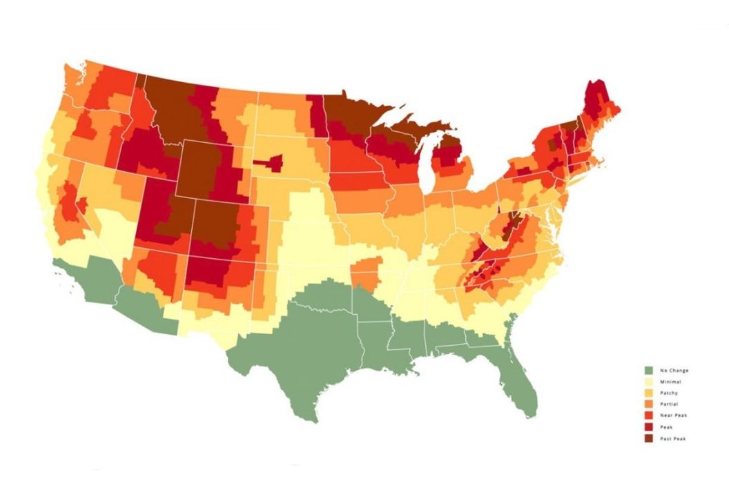
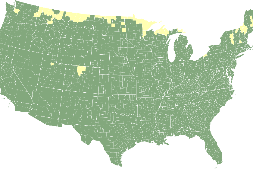
With the fall foliage prediction map, courtesy of SmokyMountains.com, you can decide where and when to travel to catch autumn's peak colors. The map shows a grid of the United States filled in with colors ranging from green to auburn. Those colors sit on a scale that you can refer back to on the side of the map, representing a range from no change in fall foliage to past-peak. According to the map, you can start catching peak fall foliage in late September up until mid-November, depending on where you go. Just move the slider at the bottom of the map to see how and where the leaves change all over the U.S. throughout the fall season.
Fall Foliage Prediction Map
David Angotti, the founder of SmokyMountains.com, is a statistical expert whose experience as an airline transport pilot using meteorological tools helped him fully understand weather patterns. Just like your everyday meteorological forecasts, his leaf predictions might not ever be meticulously accurate, but his 10-year experience of publishing fall foliage reports has proved that his algorithms have been extremely close.
"Similar to a weekend weather forecast, the timing of our map update is important," he said. "The backbone of the map is meteorology—temperature, moisture, sunlight, and precipitation. While meteorology is most accurate immediately before an event, a forecast is more useful to travelers and end users when made in advance. With our unique blend of historical and forecast data, we are able to make a highly accurate prediction by the end of August. The drastic year-to-year changes dictate that we create a new map from scratch with new data each year. Our end goal is to produce a map that's useful and fun."
What's more, users can share their fall foliage photos and help Angotti to refine his process and provide a more accurate map next year. The website not only provides a fall foliage prediction map, it includes coloring sheets for the kids and a list of the top fall leaf-peeping spots in every state.
"Each year, our customer service team fields hundreds of questions about where to view fall foliage," the website says. "This year we are releasing a vetted list of the top places to view fall foliage in all 50 states. The list, which identifies well over 100 fall viewing spots, is sure to be a valuable resource for leaf peepers!"
Why Do Leaves Change Colors in the Fall?
The science is pretty simple, as laid out by Angotti. As summer turns into fall, the trees' creation of chlorophyll slows down, meaning that leaves slowly stop turning sunlight into glucose. The leaves stop retaining the green color we normally see all year round. Thus, the color change we witness in the fall is the beginning of the death of those leaves.
As sad as that may seem, it's actually quite interesting to know that as the leaves die and fall off their trees, our earth recycles them by using their decomposing vessels to replenish the soil with their leftover nutrients. So as the seasons change over and over again, we get to witness the beautiful cycle of the lives of leaves, basking in all the colors they have to offer.
So what are some of the best places to hit to satisfy your itch for fall foliage? Grab your pumpkin spice latte and get ready to figure out where you should plan the ultimate fall getaway.
Where Should I Go to Behold Fall Foliage?
SmokyMountains.com
According to Angotti's map, leaves start showing color changes at the end of August in the far north of the country and at higher altitudes in places like Wyoming, Utah, and Colorado. By mid-September, the color changes spread further south to include Wisconsin, Michigan, New York, New Hampshire, and Maine, and further south at the northern borders of Arizona and New Mexico. But here's where this map becomes extremely useful. By the time we get to the third week of October, you'll see that while you have near-peak fall foliage in the Midwest near Tennessee and on the East Coast near North Carolina, places in the Northeast in the New England area, such as Vermont, will already be past peak.
So as long as you time it right—whether you decide to take a road trip, hike a national park, or check out your local state park—you can essentially find the best display of fall colors anywhere within the U.S.