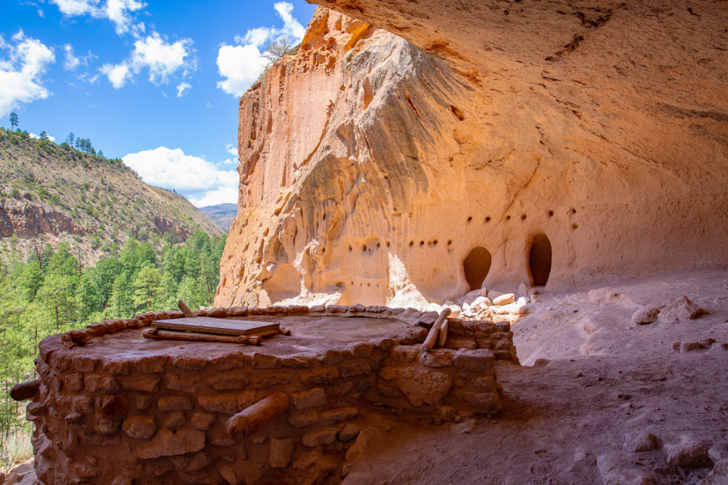
There's a reason New Mexico is known as the "Land of Enchantment," and you'll see what that reason is if you ever visit Bandelier. Located just outside the Los Alamos area in the Jemez Mountains, nature meets history in what is undoubtedly one of the United State's most stunning national monuments. This mesa country destination is covered with miles of trails that lead curious explorers past preserved pictographs and ancient cave dwellings that date back as far as 1150 AD.
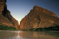
Situated on New Mexico's Rio Grande River between the towns of White Rock and Cochiti, Bandelier National Monument can't be missed if you're traveling in the Southwest. Since it's only a short drive from popular cities like Santa Fe or Albuquerque, it's easy to get to and can even be reached by shuttle bus. No excuses!
In addition to hiking and camping, Bandelier is a great destination for boating, picnicking, and cross-country skiing. What's more, the park is an excellent place for scouts to complete the necessary requirements for a whole mess of merit badges. No matter your reason for visiting the park, we hope the following tips make your trip as enchanting as the land itself.
The History of Bandelier National Monument
Although there is evidence of human activity going as far back as 10,000 years in the Bandelier area, the permanent settlements that still stand there today only date to 1150 AD. For better or worse, the first Spanish settlers started arriving in the area during the 1700's.
It wasn't until 1916 that the U.S. passed legislation that made Bandelier a national monument. Construction of its facilities started in the 1920s during the Great Depression, and many of those original structures are still there today.
Bandelier National Monument Camping
RELATED: How to Get the Most Out of a Southwest Road Trip
Unfortunately, you can't stay in Bandelier's ancient cave dwellings like the Puebloan people once did. However, the park does have several campgrounds to choose from. Make sure to reserve your spot through nps.gov well in advance.
Juniper Family Campground: This site is located near the park's entrance right off the aptly named Entrance Rd. It has all the sort of modern conveniences you could hope for like bathrooms, picnic tables, and grills. RVs and trailers up to 40 feet in length are also welcome. Although the Juniper site does have a dump station, it doesn't have showers or electrical hookups.
Ponderosa Group Campground: Bandelier's larger campsite is located several miles down Highway 4 from the park. It is intended for groups of 10 to 50 people, making it perfect for scout troops, family gatherings, and other large assemblages.
Backcountry Camping: Backpacking is more than welcome in Bandelier, but interested parties have to get a permit from the National Park Service first. The good news is permits are free, although you do have to get them in person within 48 hours of your excursion.
Hiking Trails to Explore
Everyday hikers and day trippers will be happy to know the monument has a handful of short trails to choose from. Here are some you shouldn't miss:
Main Loop Trail: This trail is about a mile and a half long and passes popular sites like the Big Kiva communal meeting place, the Tyuonyi food storage ruins, and a Long House attraction.
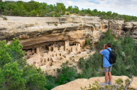
Alcove House Trail: This half mile trail branches off from the Main Loop. Visitors climb a series of four wooden ladders to reach an ancient cliff dwelling that was once known as Ceremonial Cave. The whole experience is only a one mile loop round trip.
Falls Trail: The trailhead for this one is located near the Bandelier Visitor Center and is not wheelchair accessible. At a mile and a half long, the trail descends about 400 feet to Bandelier's Upper Falls.
Tsankawi Trail: This trail is 12 miles away from the main park area. It's less than two miles long and leads across a mesa top past features like petroglyphs and cavates, not to mention a settlement that once belonged to the Ancestral Pueblo People.
Frey Trail: According to the NPS, this 1.5-mile trail used to be the primary path through Frijoles Canyon. That was before the park's Entrance Road was constructed in the 1930's. It starts near the Juniper Campground, follows the canyon floor, and is considered an easy-breezy way to enjoy sights like birds and wildflowers.
Frijolito Loop Trail: This trail is a little more difficult at about 2.5 miles in length. It passes an unexcavated archeological site and *gulp* you might even seen a tarantula or two on your way.
What's your favorite part of Bandelier National Monument? Make sure no one misses out by sharing on our Wide Open Roads Facebook!